
 Click here to take the quiz!
The Earth is a sphere with a radius of about 6,400 km. It has four main layers: the crust, mantle, outer core, and inner core. The outermost layer of the Earth is called the ①  . It is made up of different types of rocks, such as basalt, granite, marble, and sandstone. Rocks are made up of minerals, and minerals like gold, silver, iron, diamonds, and coal are examples you might recognize.
 . It is made up of different types of rocks, such as basalt, granite, marble, and sandstone. Rocks are made up of minerals, and minerals like gold, silver, iron, diamonds, and coal are examples you might recognize.
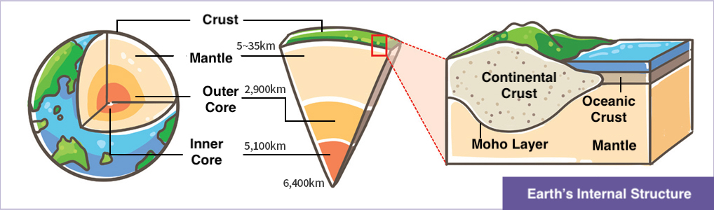
② is the science that studies what the Earth is made of and how it was formed. ③ study the distribution of rocks, the structure of soil, layers of the Earth, and ancient fossils, and also predict, explore, and research the distribution of underground resources such as gold, silver, copper, diamonds, platinum, oil, coal, and natural gas. Geologists collect rock samples, perform various experiments, and use microscopes to study the rocks closely. They also use tools like hammers, compasses, clinometers, and magnifying glasses while collecting and examining rocks.
Geologists use hammers to break rocks off from rock layers. They use a compass to check direction and a clinometer to measure the angle of the layers. Magnifying glasses help them look closely at rocks and fossils. All observations are written down in notebooks, and the shapes of the rocks are sketched. If more study is needed, the rocks are marked in the notebook or on a map. Sometimes, the rocks are cut into thin slices to look at them under a microscope. You can also prepare a hammer and magnifying glass to observe the rocks around you. What is my profession? ③
is the science that studies what the Earth is made of and how it was formed. ③ study the distribution of rocks, the structure of soil, layers of the Earth, and ancient fossils, and also predict, explore, and research the distribution of underground resources such as gold, silver, copper, diamonds, platinum, oil, coal, and natural gas. Geologists collect rock samples, perform various experiments, and use microscopes to study the rocks closely. They also use tools like hammers, compasses, clinometers, and magnifying glasses while collecting and examining rocks.Geologists use hammers to break rocks off from rock layers. They use a compass to check direction and a clinometer to measure the angle of the layers. Magnifying glasses help them look closely at rocks and fossils. All observations are written down in notebooks, and the shapes of the rocks are sketched. If more study is needed, the rocks are marked in the notebook or on a map. Sometimes, the rocks are cut into thin slices to look at them under a microscope. You can also prepare a hammer and magnifying glass to observe the rocks around you. What is my profession? ③
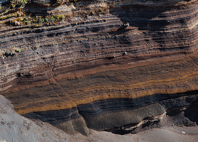
Strata
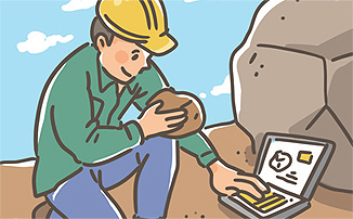
Geologist
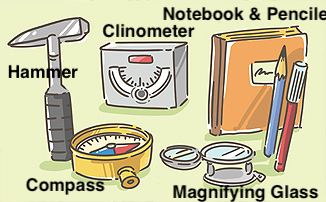
Geologist’s Tools

Various Minerals.
Click here to take the quiz!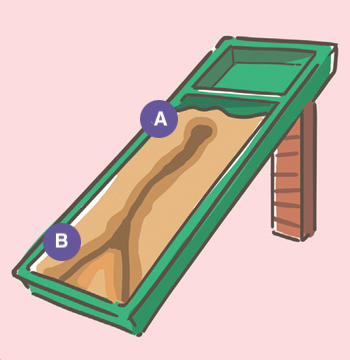
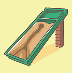
(a) Flume with more water
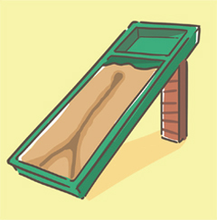
(b)Flume with less water
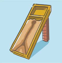
(c)Flume with a steeper slope
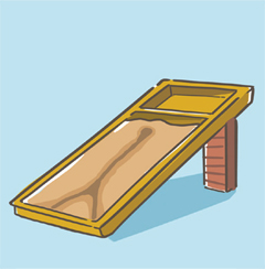
(d)Flume with a gentler slope
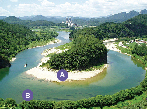
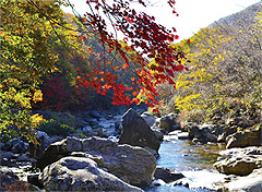
Unique Landforms of the Donggang River
Click here to take the quiz!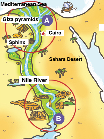
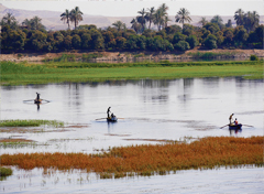
Map of the Nile River
| (A)Lower Nile | (B)Upper Nile | |
|---|---|---|
| River Width | ⑨ a.Wide/b. Narrow |
⑩ a.Wide/b. Narrow |
| River Slope | ⑪ a.Steep/ b.Gentle |
⑫ a.Steep/ b.Gentle |
| Common Features | ⑬ a. A Rocks, large stones/b. Sand, soil |
⑭ a. A Rocks, large stones/b. Sand, soil |
| Dominant Process | ⑮ a.Deposition B Erosion/b. Erosion |
⑯ a.Deposition B Erosion/b. Erosion |
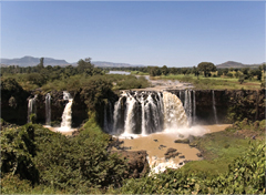
(a) Photo courtesy : A.Davey at flickr
(b)
(c)
Photo courtesy :
Santafe TM at wikimedia
(d)